04 - 06 November 2025 09:00 - 13:00 Virtual
04 - 06 November 2025 | 09:00 - 13:00 | Virtual
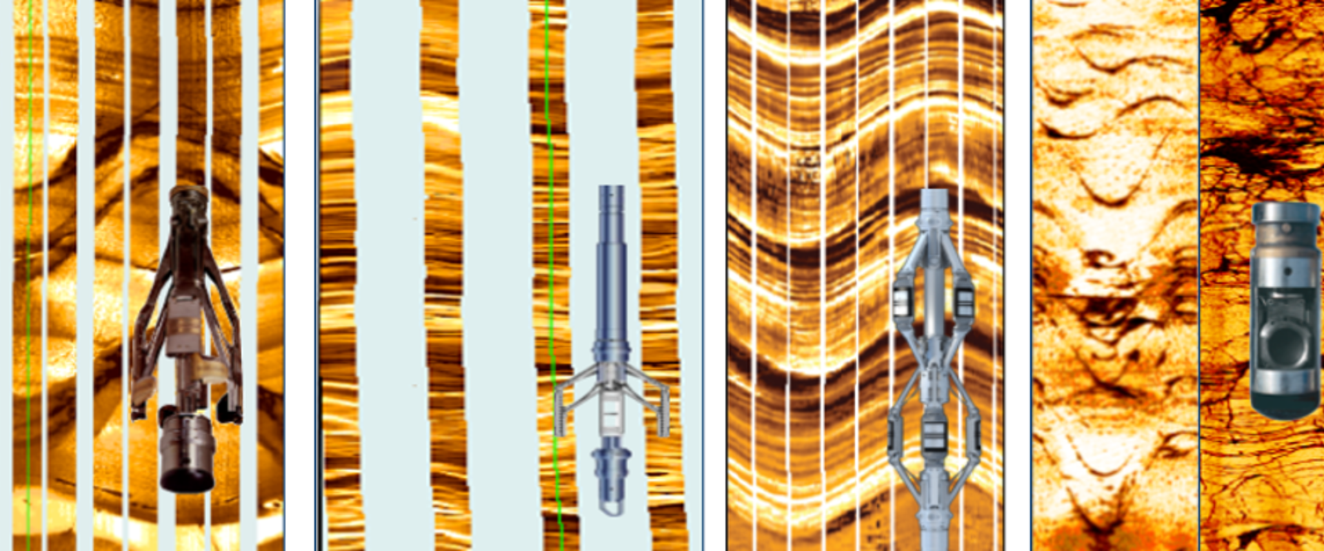
This course is concerned with the historical development, physical measurement principles and applications of technologies that were originally designed to obtain the orientation of strata in the subsurface, and are now used to provide a full geological description of the formations crossed by the borehole. Both wireline and logging-while-drilling imaging services will be extensively covered.
You will be taken on a journey from a humble beginning, when a mere three sensors on a wireline dipmeter tool were used to determine the dip angle and direction of planar features in the subsurface, to later generations of logging services allowing for high-resolution imaging with full azimuthal coverage, up until the most recent developments of at-the-bit image logging.
- Demonstrate the main objectives, benefits and limitations of dipmeter and borehole image logs.
- Describe the principle of downhole navigation systems, dip computation methods and the basic rules for dipmeter log interpretation.
- Compare the physical measurement principles and tool specifications of electrical and acoustic borehole image logging tools.
- Evaluate the complexities of borehole image logging in special environments such as oil-base muds, heavy oil, bad hole sections.
- Explain the basics of processing borehole image logs, quality control of field and processed data and the recognition of acquisition, processing or drilling artifacts.
- Present the basics of a structural and/or geomechanical interpretation from borehole image logs.
- Explain the approach towards a sedimentological, textural interpretation of borehole image logs and towards integrated facies analysis.
- Recommend appropriate borehole image logging tools and processing and interpretation methods in clastic and carbonate environments.
- Understand the benefits and limitations of borehole image logs in an integrated wellbore analysis. Be able to discuss core – borehole image log calibration issues.
- Understand the principles and practices of LWD technologies and their use in the evaluation of deviated and horizontal wells.
- Understand the way in which LWD measurements can identify productive zones and how they can guide the placement of the wellbore towards the most productive parts of the reservoir.
- Familiarise yourself with a number of non-geosteering applications of LWD technologies.
The course will be suitable for a wide range of professionals including petrophysicists, geophysicists, geomodellers and reservoir engineers from oil, gas, geothermal, water, nuclear and CCS Industries who have used or are planning to acquire dipmeter logs / borehole image logs as part of their data acquisition campaign.
This course will be held virtually over three half-days on the following dates, starting at 9:00 GMT and ending at approximately 13:00 GMT:
Module 1: Tuesday 4 November
Module 2: Wednesday 5 November
Module 3: Thursday 6 November
Joining details will be sent out the day prior, alongside any course materials that may be needed.
Introduction, physical measurement principles, structural and geomechanical interpretation of dipmeters and borehole image logs acquired on wireline:
Introduction
- History of dipmeter logging
- Surface resistivity measurements
- Inclinometry systems
- Dip computation methods
- Basic dipmeter interpretation rules
Physical measurement principle of commonly used electrical borehole image wireline logs
- Acquisition of electrical borehole image logs
- Tool specs: resolution, sampling rate, coverage etc…
- Log quality control, recognition of artefacts
- Inspection of field data
Other types of Borehole Image Logging
- Common acoustic borehole image logs
- Electrical imaging in Oil-Base Mud
- Cameras, videos
- Rock sampling and core-Log calibration
Structural interpretation of borehole image logs
- Dip set classifications
- Structural dip determination and removal
- Faults, micro-faults, unconformities, fractures
- Thin bed analysis, sand count
- Common interpretation software, demo
- Stereographic techniques
- Near-wellbore cross-sections, pseudo-3D displays
Geomechanical/Fracture interpretation of borehole image logs
- Fracture classifications
- Fracture aperture calculation
- Basement interpretation and fractures
- In-situ stress analysis
- Borehole shape anomalies
- Discrete Fracture Network modelling
Sedimentological, facies and textural interpretation of borehole image logs acquired on wireline:
Sedimentological interpretation of borehole image logs
- Common key sedimentary structures resolvable with borehole images (bedding, planar/trough x-bedding, scours, soft sediment deformation, slumps…)
- Palaeotransport analysis
- Clastic reservoir evaluation examples
- Carbonate reservoir evaluation examples
Textural borehole image log/facies interpretation
- Background resistivity determination
- Summary logs (isolated/connected vug analysis, resistivity patches etc...)
- Electrofacies classification
- Introduction to Reservoir Rock Typing
Examples of integrated analysis (image logs, core, petrophysical/production data)
Physical measurement principles and applications of Logging-While-Drilling image logs:
LWD Physical Measurement Principles and Tools
- Depth Measurements
- Measurement while Drilling
- Realtime v Memory data
- LWD Imaging principles and acquisition method
- LWD Laterolog resistivity principles and sensor design
- Common issues with LWD images
- Quality Control of LWD images
- Downhole Compression
- Overview of available LWD imaging services
- Emerging capabilities (OBM imaging, acoustic images)
Geosteering with LWD images
- LWD Realtime applications
- Geosteering/Well Placement challenges
- Correlation in HA/Hz wells and Drilling Polarity
- Practical Image interpretation while drilling
- Steering methods (Reactive/Proactive)
- LWD images in Horizontal holes
- Limitations of LWD images in Geosteering
- Keys to success in Geosteering
- Quantifying Geosteering results
Non-Geosteering applications of LWD images
- Log assurance and Drilling decision making
- Post drilling applications review
- Dip analysis
- Structural interpretation and analysis
- Fault characterization
- Integrated studies for Rock-typing
- Fracture studies
- Geomechanical analysis
- LWD v Wireline Then and now
- Image resolution comparison
- Completion Optimisation
- Invasion and time lapse analyses
Jurry van Doorn
Jurry (35 years’ industry experience) is a geologist with 35 years’ experience in the oilfield service industry. During his career he has focused on dipmeters, geochemical logs, borehole image logs, sidewall coring acquisition and core analysis. Since his retirement from Schlumberger, he has worked as a consultant, most notably with Geode-Energy Ltd.
Dr Melissa Johansson - FGS
Melissa (28 years’ academic and industry experience) is a geologist with extensive experience in the oilfield service industry (17 years), geology consulting business (eight years) and academia (3three years). She is specialised in applications of borehole image logging technologies for the oil & gas, geothermal and CCUS industries. She recently embarked on a new project involving oil and gas decommissioning.
Iwan Roberts
Iwan's (35 years’ industry experience) main field of expertise is the geological and petrophysical characterisation of hydrocarbon reservoirs and the preparation and delivery of technical training courses. During his 30 years with Schlumberger Iwan specialised in Logging-While-Drilling Formation Evaluation and Well Placement. He currently works as a consultant for Geode-Energy Ltd.
Fees
Fellow £500
Non-Fellow £1000
Student Member £150
Student Non-Member £300
Corporate Patron £500
GSA Member £600
Partner £850
The Geological Society of America (GSA) members discount
We offer a generous 40% discount off our Non-Fellow rate to members of the Geological Society of America (GSA). A discount code must be quoted on the registration form in order to take advantage of the discount. If you are a member of GSA and do not have the discount code, please email training@geolsoc.org.uk with proof of your membership.
Group discounts
We offer competitive group discounts on all Training Courses:
5 – 9 delegates: 20% off
10 – 14 delegates: 25% off
15 delegates or more: 30% off
For more information on how to access the Group Discount, please email training@geolsoc.org.uk
Concessions
We offer students a generous discount. Please verify your student status by either registering with your student email address, or uploading a photograph of your student identification/acceptance letter.
The Society offers a limited number of concessionary rates for those in financial hardship. Contact training@geolsoc.org.uk (Please note you may be required to provide details/evidence to support your application for this.)
If you require an invoice to register for this course, please email training@geolsoc.org.uk
Registration will close 24 hours before the event takes place.