Outer Isles Pseudotachylytes, Scotland
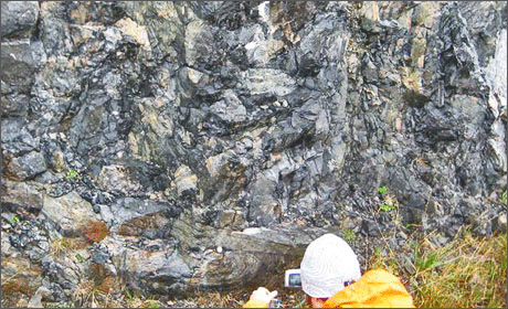
Pseudotachylytes: © Rob Butler
Earthquakes are daily reminders of plate tectonics, and devastating events occur each year. Most of the largest earthquakes occur on thrust faults, where plates are moving closer together. Some of these are at subduction zones (so-called “megathrusts”) where the ocean floor is taken back down into the mantle. Others are found at mountain ranges – where continents are colliding. The great earthquakes that occur on these thrust faults happen by the sudden release of a fault that slips at many metres a second. Not only are the rocks around the fault shattered – the intense friction can cause melting, especially in dry, crystalline rocks. These melts quench quickly to make a glass because the heat from frictional sliding is quickly dissipated. The glassy rocks resulting from this process are known as pseudotachylytes, so called because of their resemblance to tachylyte (a form of basaltic volcanic glass).
Our understanding of frictional melting on faults doesn’t come from actual earthquakes, as drilling into a deep fault as it moves remains a scientific challenge, to say the least! The insight comes instead from outcrops of faults that have long since stopped moving and have been exhumed to the Earth’s surface. One of the key outcrop sites is found along the Outer Hebrides – the Outer Isles Fault. This structure has had a long history but it certainly moved as a thrust, probably during the Caledonian orogeny that formed the structure of the Scottish Highlands. And some of the most accessible outcrops are to be found in an unprepossessing road cutting a few kilometres outside of Lochmaddy, on North Uist.
 |
|
| Pseudotachylytes near Lochmaddy: © Rob Butler |
Podcast: Listen to Nicky White of the University of Cambridge on the Outer Isles pseudotachylytes and how they tell the story of large earthquakes
Twinned with: Tohoku Earthquake 2011
The Tohoku earthquake that struck Japan on 11th March 2011 was one of the biggest earthquakes recorded in the last 100 years and caused shaking at the surface that lasted 6 minutes. It was originally read as an 8.9 magnitude quake but was recalculated as a magnitude 9 as more data became available. It was centered on the seafloor 72 km east of Tohoku, at a depth of 24 km below the surface. The main quake was followed by over 5000 aftershocks, the largest reaching magnitude 7.9. ...continue reading
Other sites
- Twin: Windward Isles
Cwm Idwal
- Twin: Mount Pinatubo
Sperrin Mountains
- Twin: Sierra Nevada
Southern Uplands
- Twin: Nankai
Ben Arnaboll
- Twin: Glarus Thrust
Outer Isles
- Twin: Tohoku Earthquake
Clogherhead and Shannon
- Twin: Papua New Guinea
Cairngorms
- Twin: New Hampshire Granites
Great Glen Fault
- Twin: North Anatolian Fault
The Lizard
- Twin: Troodos Ophiolite
Yoredales
- Twin: Antarctica
Stanage Edge
- Twin: Ganges Delta
Hartland Quay
- Twin: Zagros Range
Amroth-Saundersfoot-Tenby
- Twin: Salt Range, Pakistan
Vale of Eden
- Twin: East African Rift Valley
Zechstein
- Twin: Sicily
Alderley Edge
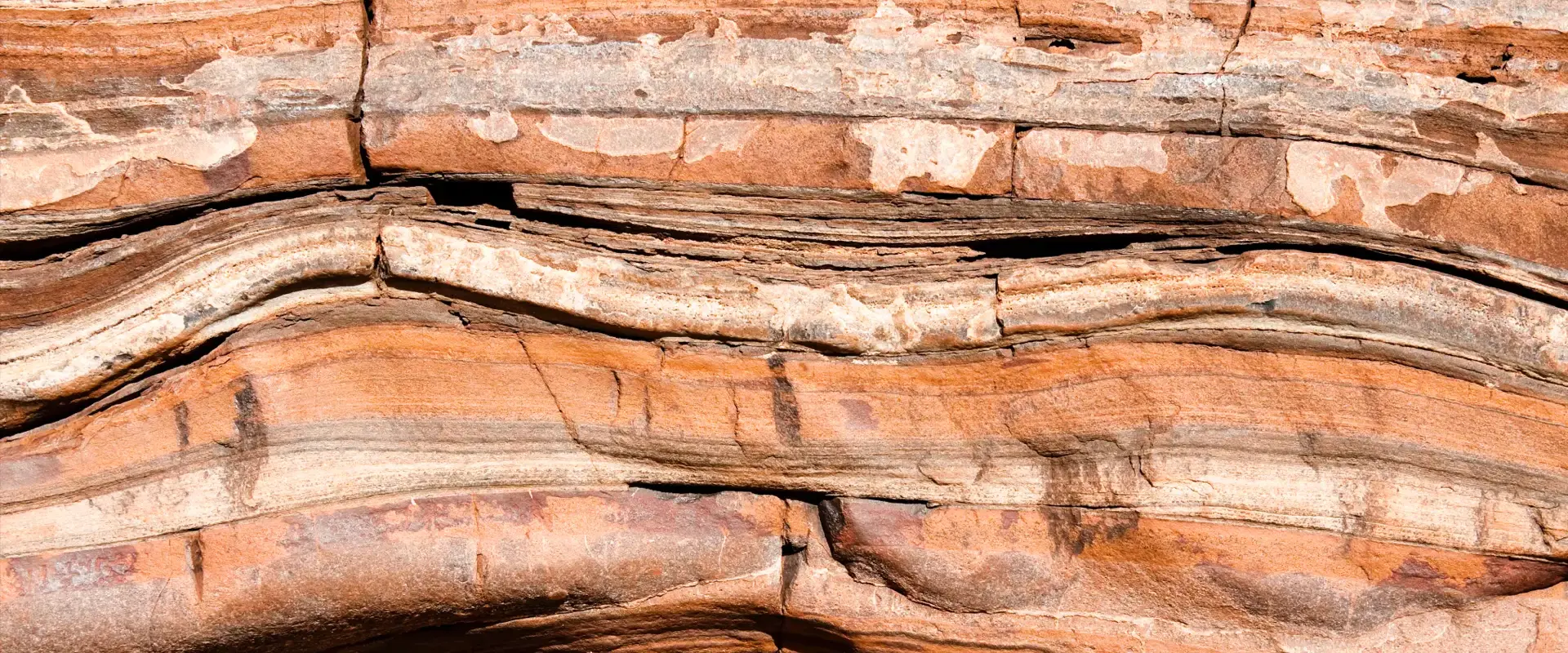
- Twin: Navajo Sandstone
Isle of Skye
- Twin: Mount Kilimanjaro
Lulworth Cove
- Twin: Albania
Giant's Causeway
- Twin: Cascade du Ray Pic